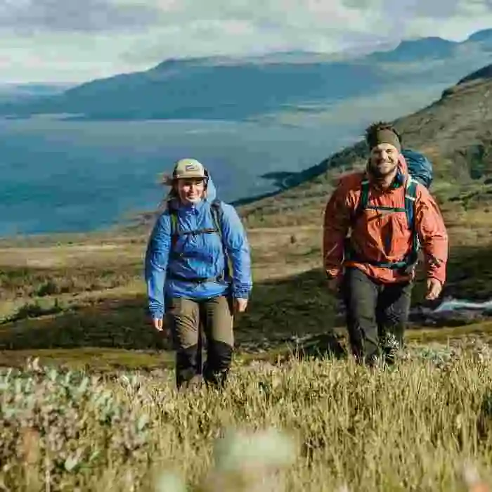
Hiking is nothing new – but in recent years, more and more people have discovered this ancient and incredibly relaxing activity can be extraordinarily beneficial for both brain and body. We believe that Björkliden is one of the country’s best starting points for hiking, regardless of whether you have never tried it before or if you are an experienced hiker with many miles under your feet. Come to Björkliden and discover summer trails lit by the midnight sun, or perhaps even better in the autumn when the mountains burn in sweeping panoply of color under the crisp, clear air. The area around Björkliden is full of both hiking opportunities and exceptional cycling trails.
GUIDED HIKING
Are you new to the mountains, or even going on a slightly bigger adventure than you are used to? Do you simply want the luxury of your own guide who can take care of a group and describe the area’s history, legacy, environment and unique things to see along the way? You’re in luck, because here at Björkliden we’re happy to help you plan your adventure together with one of our expert guides. We can both tailor something together with you or come up with suggestions if you have a general idea of what you’d like, but have not completely decided what kind of experience or destination is best. For example, a hike to Låktatjåkko mountain station over the peaks, Trollsjön, Katterjauresjön or perhaps Hjortronäventyr on Kuokelfjällen? There are nearly limitless options to explore, and we look forward to helping you build your perfect hiking experience!
Feel free to contact the booking department with your thoughts and they will be happy to help you.
0980 – 641 00 or bokning@laplandresorts.se
A SELECTION OF HIKING TRAILS AROUND BJÖRKLIDEN
LÅKTATJÅKKO MOUNTAIN LODGE
Standing at a proud 1,228 meters above sea level, Låktatjåkko Mountain Lodge is Sweden’s highest mountain station. This ancient mountain lodge is spectacularly located in a col, a pass between two mountain peaks, nine kilometers from Björkliden. From here you can experience miles of views of our magnificent mountain world.
LÅKTATJÅKKO MOUNTAIN LODGE
A visit to Låktatjåkko Mountain Lodge also implies that you should take the opportunity to eat a legendary “Låkta waffle”, which is amazing and well worth it. The hike itself offers fantastic views. First a view of the Torne marshes on the way up the mountain Namnlösa, then the mountain plateau Rákkasláhku spreads out before your eyes. The last bit offers even more of an ascent before you arrive at Fjällstationen, the mountain lodge.
There are two possible routes up to the lodge: Färdledarvägen and Sommarleden. Both trails are marked with cairns, i.e. standing stones with red-painted dots. The route guide is a bit steeper up Namnlösa, but in return you are rewarded with a spectacular view of Vadvetjåkka National Park in the northwest. The summer trail is a little kinder in its ascent, and from there you can also see what remains from when Låktatjåkko Mountain Station was built by the railway ties that were laid out in order to be able to transport the building materials. Both routes are marked with red dots on the maps of the National Land Survey and the publisher Calazos, where Färdledarvägen is the northern one and Sommarleden is the southern one. Early in the season, the summer trail can be very wet at times and should then be avoided.
Check with the reception if you want advice on the best route.
Färdledarvägen
Both routes start at Hotel Fjället and are followed for the first two kilometers. After about a kilometer, when the climb up to Namnlösa begins, Färdledarvägen turns off to the right and is at first quite steep.
The trail then flattens out when you reach Rákkasláhku. When Rakkaslahku reaches its “end”, a short precipice awaits. Here the two trails meet again at a stream that flows from the north down to the plateau, but you should keep to the right (straight ahead) and get up over the snow cover. The southern trail also goes over snow cover here (see footprints in the snow diagonally south). After the snow field, the trail follows a mountain ridge with fantastic views to the north. During the last two kilometers to the mountain station, the trails reunite and run together until you arrive.
Sommarleden
Just like with Färdledarvägen, Sommarleden starts at Hotel Fjället and after about a kilometer separates into its own path. Sommarleden, or the ‘summer trail’ continues to the left up on Namnlösa and is a little less steep that Färdledarvägen. Along the Summer Trail, follow the cairns that mark the road to Låktatjåkko Mountain Station, which have been there since the station was built. At the end of Rákkasláhku, the two trails meet at a stream that flows from the north. Just after the stream, face left and head over the snow field. Continue west and soon you will be hiking over an estuary that coming from the stream. After crossing the water you walk on hard ground and stone until about 2 km before the mountain station, where the trails meet again and follow the last bit up to the lodge.
Distance: About 9.5 km, easy path
Elevation difference: About 750 meters
Time: 3-5 hours (one way)
KRATERSJÖN (CRATER LAKE)
Do you get twitches in your legs when you think of mountain ranges and an incredible panorama, but don’t have a lot of experience hiking in the mountains? The trip to Kratersjön is ideal for you. Kratersjön is also surrounded by lovely stone slabs where you can rest your legs and enjoy a cup of coffee and the crystal clear, serene waters.
On route, along the mountain plateau you will find several typical mountain plants and probably some scattered reindeer grazing in front of the mountain tops. As always, it is important not to disturb reindeer on pasture – rather enjoy the meeting from a distance. In clear weather you can look towards the Norwegian mountains and the magnificent Cuonjávággi, or “Lapporten”. If the weather is warm, a dip in Badsjön can be a perfect spot to cool off along the way.
Start at the hotel and aim for the steep gravel slope up towards the golf course. Walk the gravel road upwards and after about 1.5 km you arrive at Badsjön. Here you follow the path on the north, i.e. the right side of the lake. After about 2 km you will reach Kratersjön. In case of bad weather, fear not, there is a windbreak located here that you can shelter in. Stay on the path if there is poor visibility!
If you want, you can also choose to turn north (right) in front of Kratersjön over the small stream and walk just over 1.5 km down to Rallarkyrkogården. From Kratersjön the path is marked with clear, red winter trail crossings all the way down to the cemetery. Be careful when crossing the railway as the trains can come fast and unannounced!
From Rallarkyrkogården you then follow Rallarleden along the railway home.
Distance: 7 km Hotel – Kratersjön round trip, 9 km Hotel – Kratersjön – Rallarkyrkogården – Hotel. Time: 3 – 5h depending on the choice of distance.
RALLARKYRKOGÅRDEN (THE NAVVY CEMETARY)
Walk along the old road where they used to bring up the materials for the railway, through the lush mountain birch forest and let yourself come out of time and place, and turn your imagination to the turn of the last century. Enjoy the small waterfalls and the supple greenery that surrounds the trail, as well as the peace and beauty of cemetery.
Imagine the life stories that this historic place witnessed – let yourself be captured by the mystique surrounding the Black Bear – the mythical woman who was one of those who built the Ofotbanan by hand at the end of the 19th century.
Trail Option 1
Start at the hotel, then take the cottage village road or the asphalt road down to the railway station in Björkliden’s village.
Cross the railway at the indicated crossing and turn immediately to the left. At the edge of the forest is an information board describing Rallarvägen and a road sign. From here the trail wanders about 3.5 km to the cemetery. The cemetery itself is on the left side above the path, and there is an information board at the trail intersection.
If you want to visit Tornehamn’s church, follow Rallarvägen straight ahead after the cemetery and look for the signs to Tornehamn. It is about 1.5 km walk down to Tornehamn from the cemetery. Turn around and take the same road back to the hotel again.
Distance: From Hotel fjället – Rallarkyrkogården 8 km round trip, from Rallarkyrkogården – Tornehamn 3 km round trip
Time: about 2-3 hours.
Option 2
Follow alternative 1 to Rallarkyrkogården and then choose to walk up to the Crater lake (Kratersjön), about 1.5 km. Then walk the hike to Kratersjön back to the hotel – see separate description. If you choose this option, you go up to the cemetery, but instead of entering through the gate, you follow the outside of the fence up to the railway.
Be careful when crossing the railway, trains can come fast! On the other side of the railway there is a path straight up the forest slope – follow this. It is a clear path but also a winter trail marked with red crosses.
Distance: 9 km (church not included)
Time: 4-5 h
SILVERFALLET (SILVER FALLS)
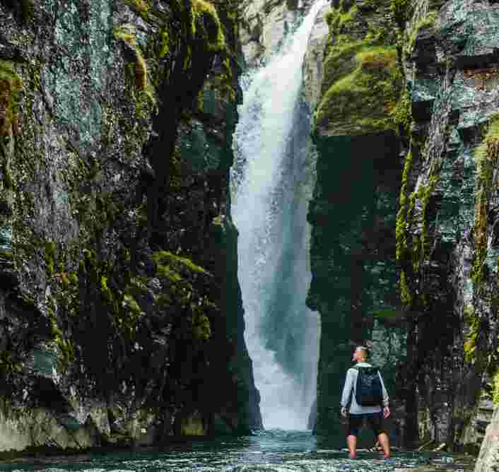
Follow Rakkasjohka down towards the Torne marshes to one of Björkliden’s most famous wild strawberry patches, Silver Falls. From here, the stream plunges into a narrow canyon which then empties into the Torne marshes. Stroll around on the beach and feel the smooth stones that the water has polished into perfect skipping stones. If you want to cool off, a quick and refreshing dip in the clear water is recommended, but it’s not necessarily what you’d call a hot tub!
Start at the hotel, traverse the lawn and go out towards the ski hill, following the path that goes up the hill. ‘
The path then leads into the forest and towards a large wooden Sami hut, Lavvun. Here the path turns straight down towards the stream. Do not cross the stream, just follow the path along the water down towards Torne marshes. After a while you come down to the lift houses and the helicopter pad, here you have to turn off onto the asphalt road for about 150 m. At the T-junction facing towards Gammelgården, look in the opposite direction and see a wooden bridge and the beginning of Rallarvägen. Before the wooden bridge over the stream, there is a path downstream towards Silverfallet after the edge of the stream – you take it!
The path goes under the E 10 and then down towards the water. There is a bridge over the stream a bit down. Beware, it can be slippery if it has rained!
Distance: 3 km round trip.
Time: 1.5 -2 h
NAMNLÖSA TOPPEN (NAMELESS PEAK)
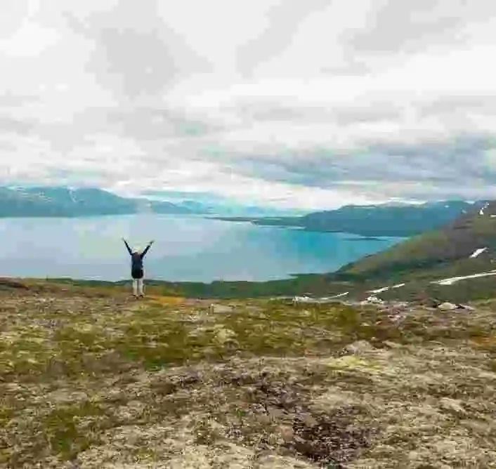
An often overlooked jewel overlooking these valleys is “Nameless” peak. Few peaks in the area offer such a fantastic view of the surrounding area, and a better place to enjoy the midnight sun. This tour begins in the mountainous birch forest, believed to be the oldest type of forest in Scandinavia, which spreads throughout the low alpine climate.
Where the mountain birch forest ends, the middle and high alpine regions begin. The border is usually drawn where grassy moors end their expanse downwards. The middle and high alpine regions are characterized such grasslands that turn into more and more rocky terrain with sparser and sparser vegetation as you move higher up.
To get to Namnlösa you start at the hotel and follow the trail towards Låktatjåkko Fjällstation. As the trail turns off at the golf course and begins gaining elevation, the ascent begins up on Namnlösa, and the trail towards Låktatjåkko Fjällstation divides here in Sommarleden and Färdledarvägen. Both routes are marked with red dots on the map (BD6). We suggest that you choose the Summer Trail, which is the southern trail. It has a slightly kinder climb up on Namnlösa. When you reach the mountain plateau Rákkasláhku, after about 2.5 km the trail starts to slope a little down, and instead of continuing on the trail, turn off and go straight north up on Namnlösa itself. From the trail to the top is about 700 m distance and 30 meters of altitude left.
Distance: Approx. 3.5 km (one way)
Elevation difference: About 400 meters
Time: 3 h
Marking: Björkliden – Nämnlösa
FLOWER TRAIL
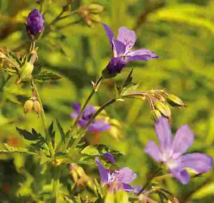
Are you keen to just enjoy a bit of nature and learn a little more about the local flora and fauna? Then our Flower Trail is perfect for you. The path takes you to some of the finest places in the vicinity of Björkliden and simultaneously offers a great deal of information about the plants you see.
The tour begins in the sports shop where there is a compendium that you may borrow to aid in your path of discovery. In the compendium you will find pictures and descriptions of over 50 plants, where it is most likely to see them, as well as a detailed tour description. The flower walk is one of the coziest walks you can do in the local area and it takes you through all our terrain types, barren forest, water, bare mountains and lush birch forest. When you return home, feel free to submit the compendium back to us for future guests in order to help us all save paper!
Distance: 2 km
Height difference: About 50 meters
Time: 1 – 2 h
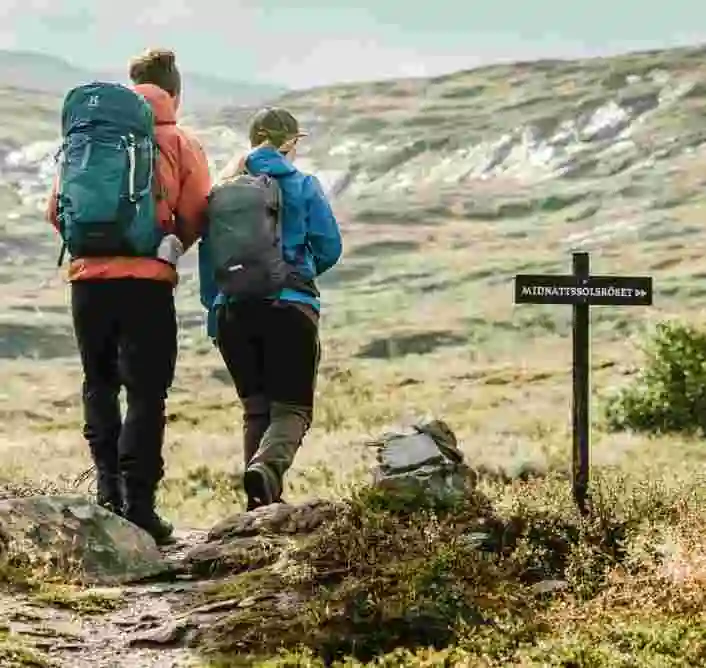
MIDNIGHT SUN TRAIL
In this unique and classic path, you’ll walk up to our midnight sun cairn and sign in to our guestbook, recording your visit for all time. Up there you’ll enjoy a phenomenal view and splendor of the sun at midnight. This is of course a lovely trip to do at other times of the day and year as well; during the right time of the year, at twelve o’clock at night the sun is directly over Pålnoviken in Torneträsk and the steep canyon walls lining the Norwegian Sördalen.
You start at the hotel and walk up the gravel road up to the golf course and the first tee. Continue up the gravel road up to a slightly smaller information sign about Låktatjåkko mountain station in English. This tour is also described there. Follow this clear path with red-marked cairns that go to the left from the gravel road. After about 500 meters, the cairns are marked in red and yellow. Follow the yellow marking that turns off to the right. You will soon see the hill with a cairn and a sign on it. You walk over some slightly wetter areas (good shoes are recommended) and then all of a sudden, you are there. When you go back, you can go keep to the right closer to the stream to get past the falls.
Distance: 3.5 km round trip
Time: 1-2 h
Height difference: about 70 m
SIN FALLS OUTLOOK TRAIL (SYNDAFALLET)
If you hike up the hill directly behind the hotel, you immediately find yourself up on a bare mountain. In this rugged, pristine environment, feel free to drink the clear water in Rakkasjohka, and gaze out over a mountain panorama that spreads out around you; if you’re lucky you may even see some reindeer grazing on the mountain.
The path for this trail starts at the hotel and aims for the trail towards Låktatjåkko Mountain Station. When you have passed the golf course’s first tee at about 50 meters, you should keep an eye out for a path on your left side. Take this path down towards Rakkasjohka, you will soon reach the Falls. Take the opportunity to drink a sip of the water and follow the path the last few meters up to the bare mountain plateau. Here when you come back on the trail towards Låktatjåkko, take it in the direction down to the hotel again. Soon you are back on a fairly well-trodden gravel path, which you can follow up to the Badsjön if you want. Otherwise, turn off downhill and aim for the hillock. Also take the opportunity to get a classic picture of the iconic Lapporten! The gravel road then takes you down towards the hotel again.
Distance: 2-3 km for the entire hike depending on the selected distance.
Time: about 1 h
TIPS FOR AN ENJOYABLE STAY IN THE MOUNTAINS
The weather on the mountain is changing constantly, and quickly. If the sun is shining when you leave the village, we still recommend that you bring a warm, insulating layer and raingear. It may be that the weather gods offer cold winds and dense fog as well as snow-mixed rain even during the late summer months. To make your hiking trip a little more interesting, inform yourself beforehand, you can buy small handy paperback books on flora & fauna that are found in the mountains. A map, compass and books can also be bought in the sports shop and at the reception. Also keep in mind that mobile coverage changes here in the mountains and is not always reliable.
If you are unsure of the day’s weather, suitable packing, time required or anything else related to your upcoming adventure, please never hesitate to ask: the reception or one of our guides in the sports shop are always happy to help. It’s also possible to rent boots or mountain bikes and our guides can help you to buy a fishing license online. Or just pop in to have a look in and try out some of the latest gear!
Should you be unsure of your route or need help, contact the reception at 0980-641 00.
GOOD TO PACK WITH YOU WHEN HIKING
Make sure to bring a first aid kit, compass, and map of current area (Fjällkarta Björkliden 1:50 000 or Calazo Kebenikaisefjällen 1: 100 000 / Högalpin Abisko – Riksgränsen 1:25 000). Also, a knife or multi-tool, seat pad, insulating layer (warm sweater, jacket), rainwear, hat, gloves, snacks / coffee, hot drink and a cup are ideal items in the mountains. Be prepared, have fun!

